blah blah blah
Eastman Mountain
Length: 8.4 miles out-and-backDifficulty (click for info): Hard
Elevation Gain: 2500 feet (+110 on return)
Rating (click for info): 7/10
Elevation: 2935'
Prominence: 375'
Driving Directions:
Trailhead and parking area are on Maine Rt. 113 in Chatham, NH. Note: because of the confusion which can arise from two different Rt. 113's (NH 113 and ME 113) being so close to each other, we have given directions for this particular hike from Conway. From the junction of NH 16 and NH 113 in Conway, drive east on NH 113. In 2.0 miles, Rt. 302 joins from the left; continue straight on Rt. 302/113. In 4.7 miles, NH 113 ends, and the road, now only Rt. 302, crosses the Maine border. In 1.1 miles from the border (5.8 miles from jct. 302/113), turn left onto ME 113 (River Street). Drive 1.2 miles (crossing back into NH), then turn right to stay on ME 113, now East Conway Road. In another mile, turn right again to stay on ME 113, now called West Fryeburg Road, crossing back into Maine. In 4.4 miles, turn right one more time to stay on ME 113 where NH 113B continues ahead. In another 3.1 miles, NH 113B enters from the left, the name of the road changes to Main Road, and it crosses the state line back into NH. Continue 2.7 miles, and turn right into a large parking area, clearly marked for Baldface Circle Trail.
About the Hike:
Eastman Mountain is the less-known southern neighbor to the huge, ledgy Baldfaces. Though its views are not as open, hikers will appreciate the solitude of its small summit when compared to the often-crowded Baldfaces. It is also a much easier peak to get to; the entire trail is in the forest and is not as steep as the crazy ledge climb up to South Baldface.
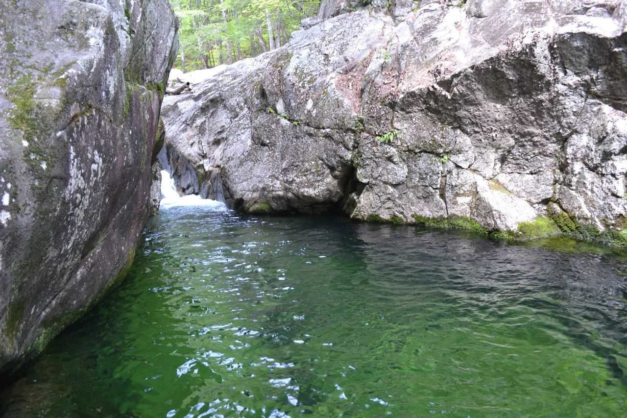
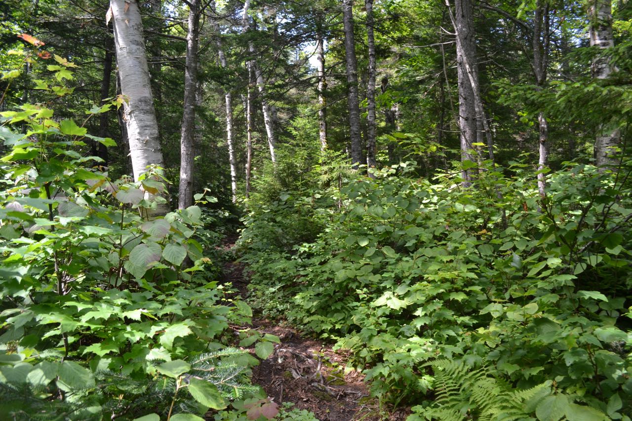
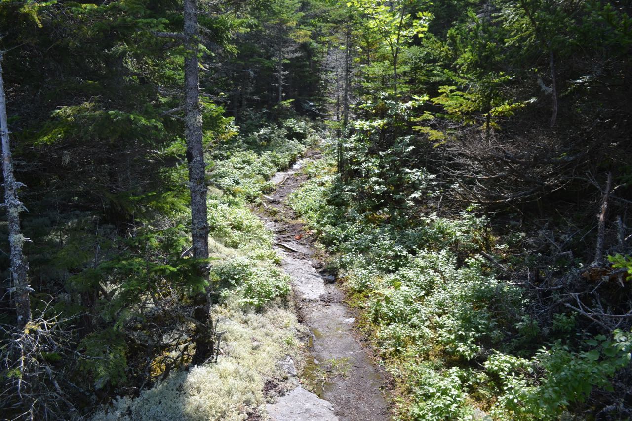
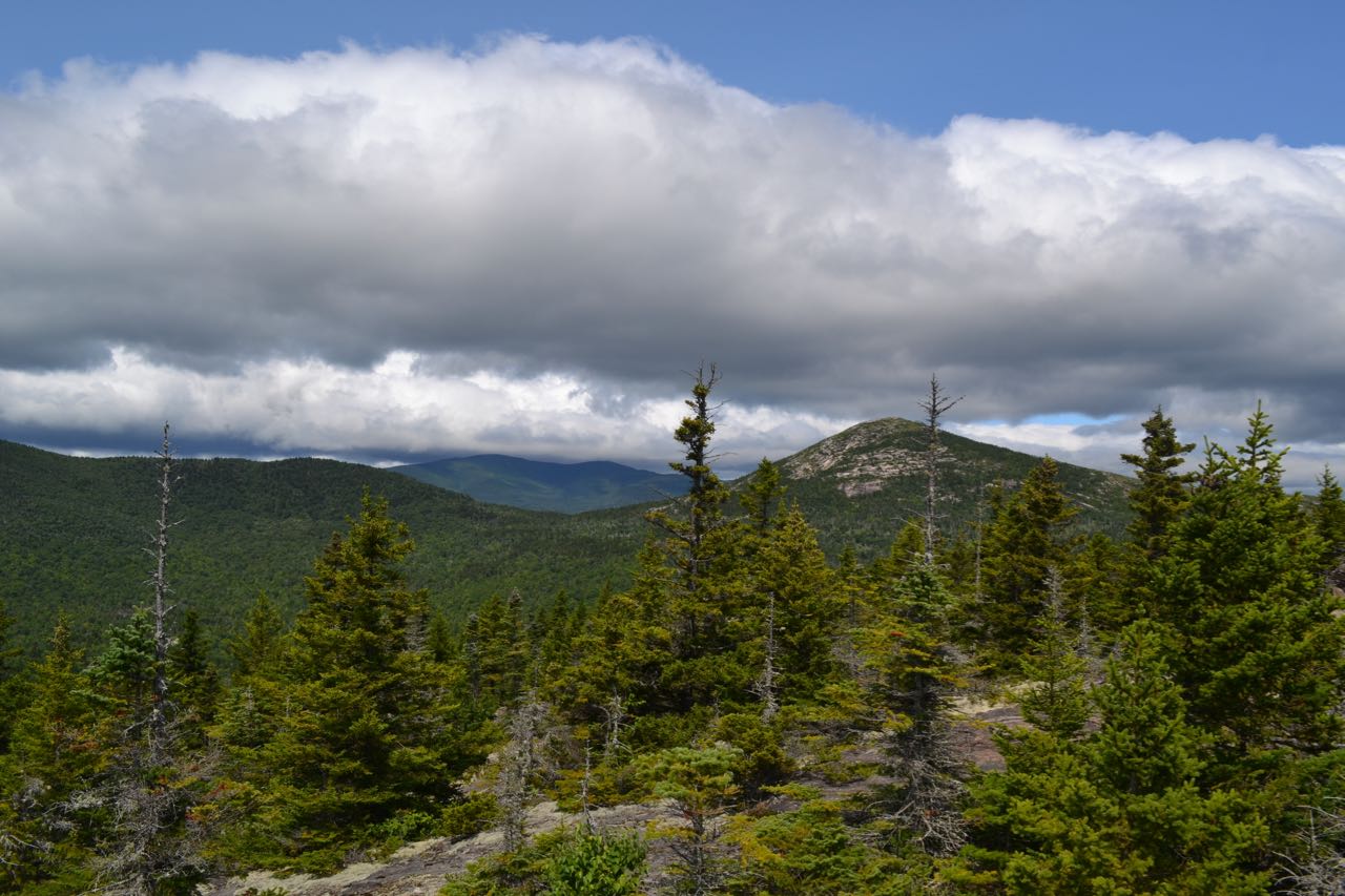
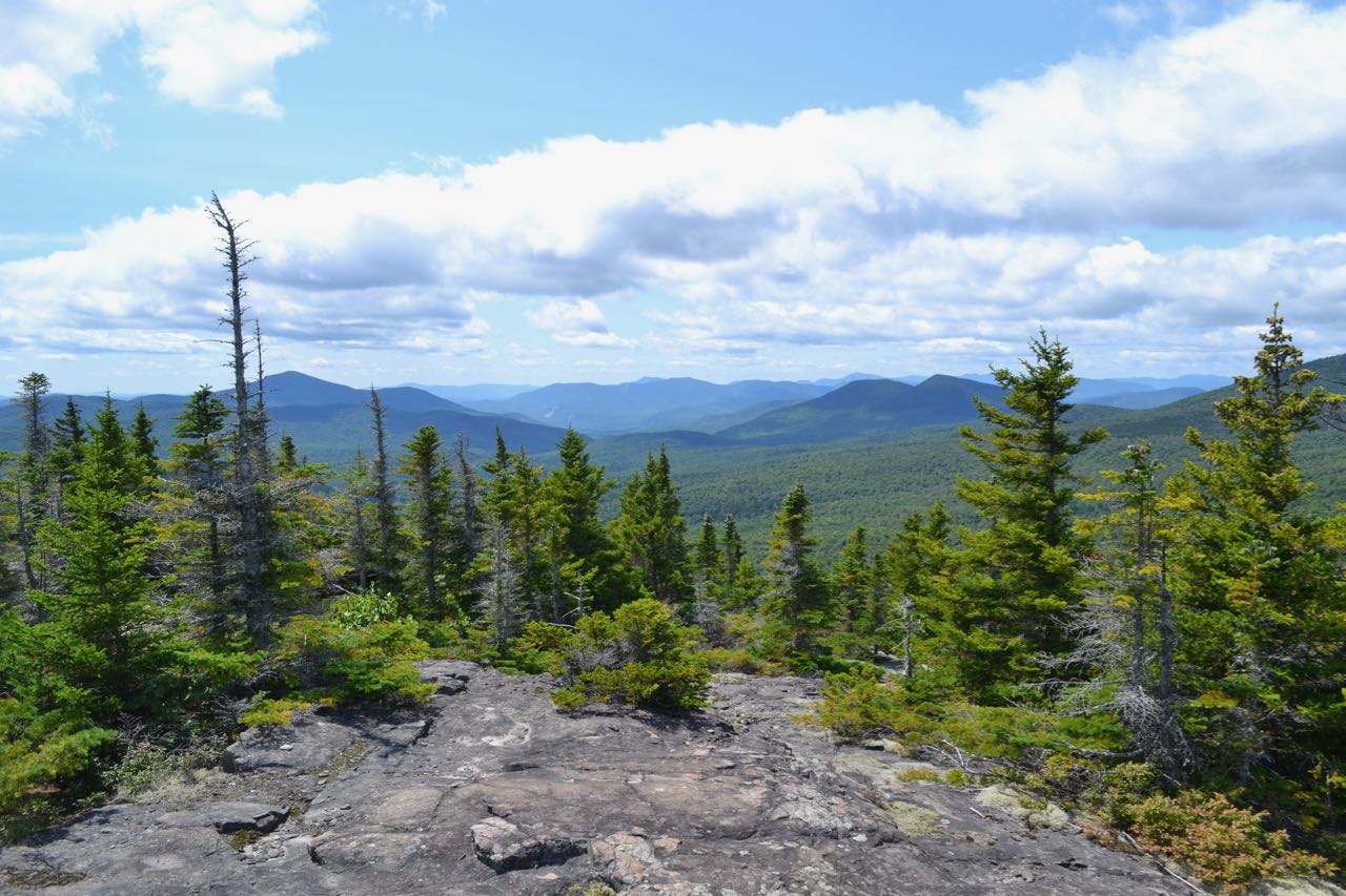
From the parking area, cross the road and walk north to the trailhead. The Baldface Circle Trail climbs a stone staircase and leads above the road for a few feet before swinging into the woods. It then begins climbing at very easy grades, over mildly rocky footing. After a pleasant forest walk of 0.7 miles, the trail arrives at Circle Junction, where it splits into a loop. Here, you will follow the south fork, but first, take a short side trip to see the lovely green-hued mini-gorge known as Emerald Pool. To see this, turn right at the sign for Emerald Pool and follow the beaten paths 0.1 miles downstream. Emerald Pool makes a nice easy hike on its own. Back at the junction, turn left onto the south fork. In 0.2 miles, as the Baldface Circle Trail makes a sharp right turn, continue straight onto Slippery Brook Trail. The trail starts out seemingly headed back in the direction you came, but soon swings back to the right and climbs over a small ridge to cross a branch of Chandler Brook in 0.3 miles. The trail continues at a flat grade before swinging uphill to join a smaller stream in 0.2 miles. From this point, it is a featureless climb of 2.1 miles to the next trail junction, getting progressively steeper. There are few flat sections along this monotonous ascent, but there are really no rocks. At the very end, just after the steepest section, the trail passes through an open area of ferns and birch trees. At the junction on top of the ridge connecting Eastman to South Baldface, turn left onto Eastman Mountain Trail. This trail begins by descending gently through open forest for just over 0.3 miles, then starts to climb the cone of Eastman Mountain. The steep climb lasts for 0.5 miles; there are some ledges starting in the forest, then the trail enters into a sub-alpine area with shorter trees and mosses lining the pathway. The summit is marked with a large cairn and has great views over the valley of Slippery Brook to the Moat and Sandwich Ranges. It also has an interesting view across the valley to close-by and higher mountains Sable and Chandler. Looking over the trees, you can see South Baldface as well. There are more ledges below the summit with different views, including one with an open view to the east into Maine.
Printable directions page